from 0 review
32 Days 31 Nights
Daily Tour
Unlimited
___
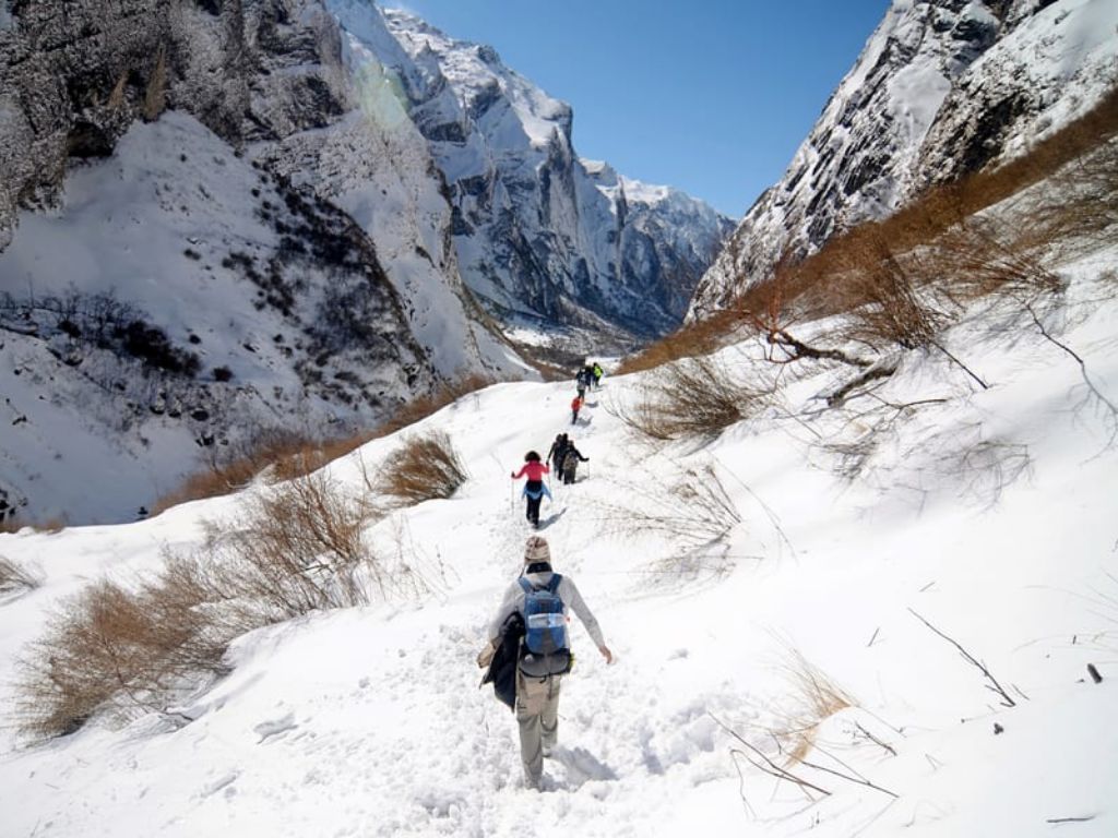
Snowman Trek is one of the most challenging and grueling ultra-endurance high altitude race in the world. The snowman trek trial covers a distance of 230 km with an extreme elevation gain of 3140 m covering five passes over 5,000 m (the highest is 5264 m), seven passes over 4,400 m, and many steep ascents and descents. The trail that will be covered by the run has been referred to by some international trekkers as “the world’s worst trail” due to its difficult and rugged nature.
Snowman Trek in Bhutan Overview:
Duration: 32 days.
Max. Elevation: 5,264 m.
Highest Camp: 5,120 m.
Standard: Hard.
Best Seasons: Mid June to Mid October.
Start: Gunitsawa Village, Paro Valley.
Finish: Duer Village, Bumthang.
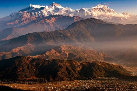
Paro During this flight one will enjoy the view of Mt. Everest, Mt. Kanchenjunga and other Himalayan Mountains including the sacred Mt. Jhomolhari& Mt. Jichu Drake in Bhutan. On arrival at Paro Airport you will be received by the representative of Atlas Tour and Travel and transfer to the hotel. Afternoon, visit Ta Dzong former Watch Tower which now houses the National Museum and then visit Rinpung Dzong which houses the monastic school and the office of the civil administration and walk down passing close by crossing the Bhutanese typical wooden roofed bridge to Paro town. After a short stroll in town drive back to hotel for the night halt.
After early breakfast drive up to the Ramthangka (base camp) of Taktsang and then hike up to the most famous monastery Taktsang, the Tiger's nest. This magical monastery clings to the vertical granite cliff of 3,000 above the valley floor. It is believed that Guru meditated here in the 8th century. The disciples of Guru built the temple, which was later enlarged by Zhabdrung in the 17th century. After lunch walk back down. Further drive towards the north to visit ruins of Drukgyel Dzong built in 1646 by Zhabdrung Ngawang Namgyel. From there one can see Mt. Jumolhari (mountain of goddesses) overnight at hotel.
Drive up to Drukgyel Dzong where the motor-able road ends and the trek to Shana begins a start which is about 5 to 6 hours walk with gradual climb following the Paro river through the agricultural valley and villages. The campsite is opposite the army check post in the meadows, near the river at an altitude of 2,580m.
The trail is gradual ascend following the Paro river through the conifer forest and Rhododendron. The path narrows and closes in and the trail winds up and down along the drainage. Camp is in the meadow with stone shelter built for trekkers surrounded by conifer and birch forest and on clear days one can have a magnificent view of Mt. Jhomolhari suddenly peeping at you through the clouds.
The trail leads bypassing the array post and the valley begins to widen and come by the winter house of yak herder where hot lunch will be served in one of the houses. Will camp beneath a ruined for tress at the base of Mt. Jhomolhari.
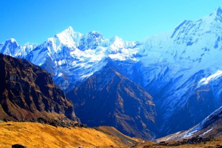
The day in Jangothang provides plenty of possibilities for day hikes with great views on lakes and snow capped mountains such as Jhomolhari and Jichu Drake. There are good chances to spot some blue sheep on the upper
fter your breakfast you start ascending up the mountainside towards Nyelila. During the ascend you will be seeing the Mt. Jhomolhari, Mt. Jichu Drake and Tsherim Gang till Nyelila at which point you will be seen off by the former two mountains. There after you will be seeing only Tsherim Gang. From Nyelila pass the trail leads you all the way down to the camp.
The walk is through Gongyuel village and if you are lucky you might see the Raven bird and herds of blue sheep is no miss. Then you get to a small village called Chebisa, winter house of yak herders.
As you ascend the steep hill side till Gobula pass, Alt. 14,268 ft. From Gobula pass the walk is a very gradual descend till you get to the tree line which is the campsite by the river.
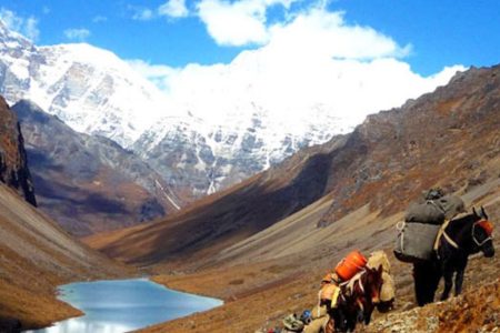
The walk starts a little early and we head towards Jhari La pass 4760 m. From here you drop to Tsharijathang, the valleys where herds of Takin are usually seen grazing in the meadows. Halt night in camp.
You will be passing over the highest point on this trek, Shingela Pass at 16,072ft/4,870 m. The walk is tough till the top, and from there you start descending towards Lemithang. You trek through the valley till Lemithang, which is under Laya District. Here you will see kids in funny hats. Camp at Lemithang is beneath Gang Chen Ta, Great Tiger Mountain. If time permits it is worthwhile to spend a day of exploration here. Night will halt in camp.
The walk for the day is all the way downhill along a winding river. As you walk down, the path splits in two, one going down in the direction of the river to the campsite which is also used by the army, and the other maintains almost the same height and leads you to the west side of Laya village. You can camp on this flat bench sort profile above the East End of Laya village.
Rest and explore the Laya village.
The trek leads gradually downhill to the Lunana trail junction, and then makes a gradual climb to the camp through a forest of conifers, maple and rhodendron. The Trail improves and becomes wider as we climb out of the river valley. Halt camp at Roduphu near a small stream.
It is a long hike crossing the Tsimo La pass at 4950m(16,200) and descending Narethang.The campsite at Narethang is towered by the peak of GanglaKarchung (6,395m).
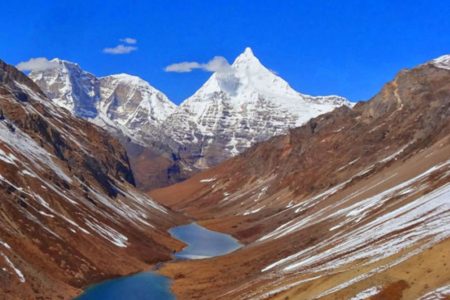
From the camp you will climb for about an hour to GanglaKarchung La (5,120m) climb to Karchung La pass at 5240m(17,187 ft) and down the glacial lakes that are the source of Tang Chhu river, above the lakes are the mighty peaks of Jejekangphu Gang (7300m) and Tsenda Kang (7100m). Halt camp in Tarina.
The walk leads down through conifer forests following the upper ridges of the Pho Chhu, passing some impressive waterfalls. The trail then climbs over a ridge and drops to Woche, a settlement of a few houses, the first village in the Lunana region
It's a steady climb from Woche to the keche La pass at 4580 (15,100 ft), then downhill to Thega village. The hike continues to Lhadi village where we camp.
The trail climbs gradually following the main source of Pho Chhu to Chozo village. Above Chozo the valley opens as we approach Thanza village near the foot of 71oom ZogophuGamp, which is known as table mountain, camp site at Thanza.
Thanza-Halt have fantastic opportunity to interact with the hospitable local villagers and explore the beautiful surrounding till the farthest point in Lunana valley. As Thanza is a transfer point for horses and yaks, it is important to have a day here for our staff to ensure all the necessary yaks and rounded up by the local herders.
Having chosen the route to Bumthang the trek starts by climbing a ridge with a great view of Table Mountain and Thanza valley below. The ridge altitude is 4,500m and it rises gradually up to 4,650m. After lunch, walk upwards towards the left side of the bridge to enjoy the view of snow-capped mountains. You reach the campsite of Tshorim after climbing more ridges.
This is one of the highlights of the trek and the day starts with a short climb to the Tshorim Thso. You walk on the side of the lake enjoying a panoramic view of the Gophu La ranges. The last climb to the Gophu La pass (5,230m) is very short. After the pass descend to the base camp, walking along the ridge to enjoy a great view of Gangkhar Puensum. If interested, one can divert to the left side to climb up the Pyramid Peak for a better view or you can go down to the base camp nearby Sha Chhu.
The trail further follows the Sha Chhu and descends gradually to Geshe Woma.
The path continues following Sha Chhu for two and a half hours until the stiff climb to Saka La begins. Visibility along the Saka La trail is poor so one must see top of the ridge for guidance. After having lunch nearby a yak herders' camp you climb up to Saka La (4,800m). The path then descends to a couple of lakes and another short ascent is stunning. Scenery once again is beautiful with small lakes and the mountain peaks.
A one hour climb leads to Juli La (4,700m). After the pass, you descend to the riverside through dense rhododendron, juniper and conifer forests. After the bridge a short climb leads to Duer Tsachu. These hot springs, where Guru Padmasambhava is supposed to have taken bath, might be the most stunningly beautiful hot springs of the Himalayas. You might want to spend an extra day at Duer Tsachu.
From the hot springs it is a long and steady climb again with great views of mountains in Lunana. You will also come across blue lakes and yak herder huts.
This is the last day of the trek and your porters change from yaks to horses. The path follows the Chamkhar Chhu, descending gradually with a few climbs in between. The trek ends here when you arrive at Duer village. From here you drive to Jakar (Bumthang).
After Breakfast drive to Phobjikha via Pele la Pass at the altitude of 3,150 meters, a wonderful opportunity for photographs. En-route stops at Chummy village to visit Yathra weaving central. Which Yathra are made into colourful scarves, bags, blankets and sweater. Continue drive to Phobjikha a bowl-shape valley on the western slopes of Black Mountain, visit Gantey Goenpa as it is a major attraction with an old monastery date back to the 16 century. Later walk around the valley which is also the winter home to the rare black-necked cranes, which migrate, from remote parts of Tibet, China and Siberia during winter to this valley. Overnight will be at hotel.
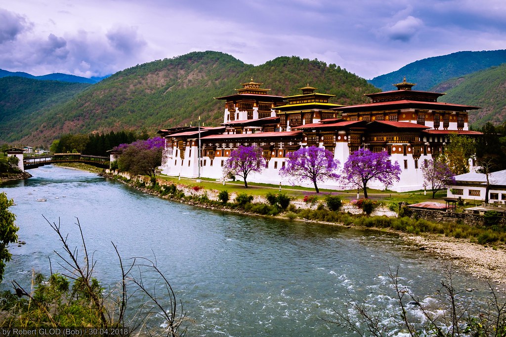
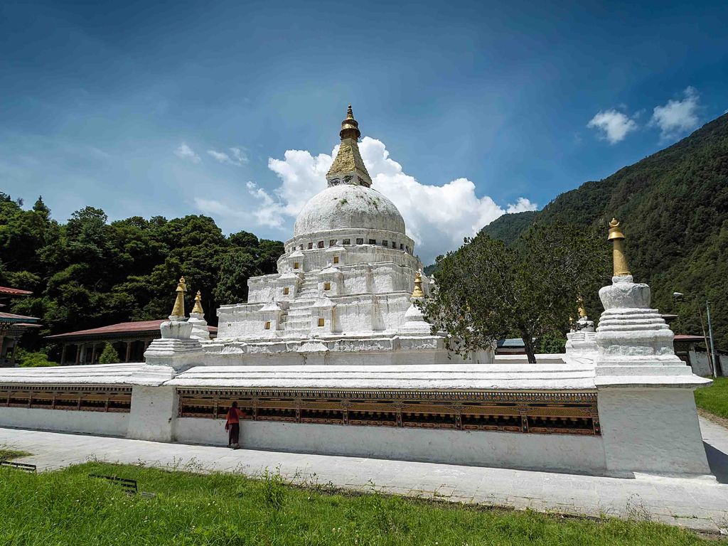
After breakfast drive to Punakha. On the way visit ChhimiLhakhang - this was built in 15 Century (dedicated to Lama Dukpa Kinley also known as divine mad man). It is a pilgrim site especially for childless couple and is a half an hour walk across a local village and rice field. Everyone in this kingdom believes that the Lam's blessings will help a woman conceive. After lunch visit Punakha Dzong- built in 1637 by Zhabdrung. It is one of the most beautiful Dzong in the country. Later walk around Punakha and Khuruthang town. Overnight at hotel.
After breakfast, drive to Thimphu-approximately 3-hour drive through picturesque valleys and mountain slopes dotted with typical Bhutanese villages. From the Dochula pass, at over 10,000ft, vast panoramic views of the high snowcapped peaks of the Bhutanese Himalaya can be enjoyed on a clear day. Lunch will be served at Dochula cafeteria. And you even have an opportunity take a picture of Dochula, 108 stupas. Continue drive to Thimphu. Overnight at hotel.
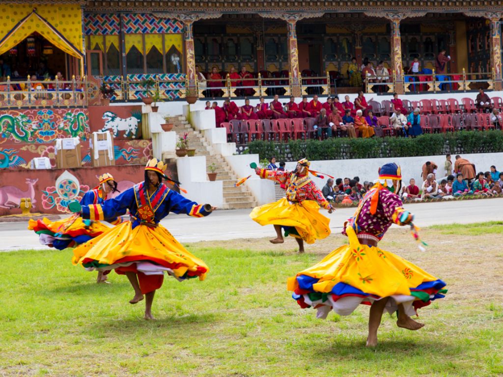
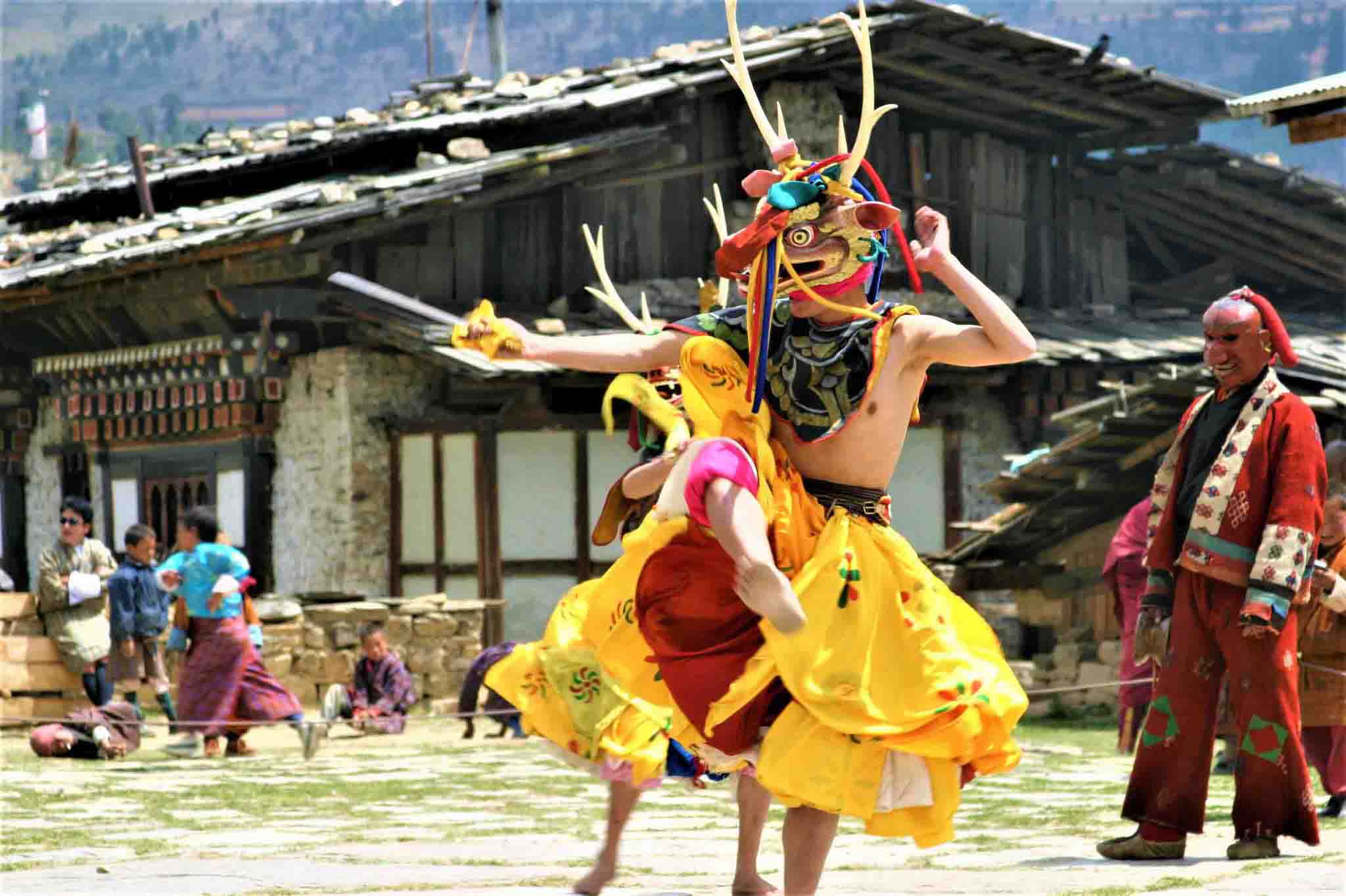
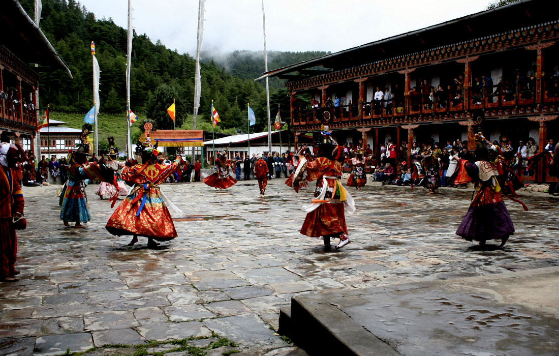
Thimphu Sightseeing – Folk Heritage Museum, National Institute for Zorig Chusum, Zelukha Nunnery, National library, Memorial Chorten, Handicraft Emporium, Memorial Chorten, Buddha Point, Changangkha Lhakhang and stroll around Thimphu town. Drive back to hotel for the overnight stay.
After breakfast, drive to Paro international airport for your onward flight. The representative of Atlas Tour and Travel will see off and bid farewell.